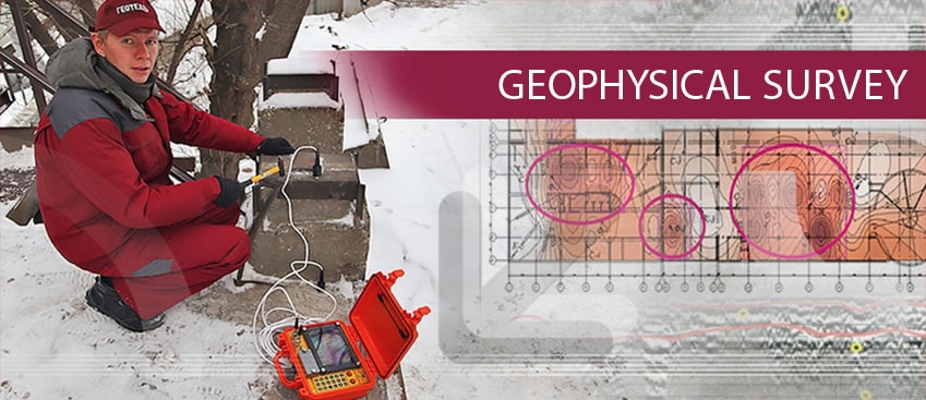
Geophysical Survey in Russia
With twenty years of continued success, the Geotech-Logis Group of companies is Russia’s leading manufacturer of geophysical equipment, providing high quality Ground Penetrating Radar, seismographs and geoelectrical instruments.
For more than 20 years, the company has provided services for geophysical surveys in the territories of cars and railways, airfields, construction sites.
A considerable experience has been accumulated in carrying out geophysical surveys in the territories of hydroelectric power stations, thermal power plants, nuclear power plants, water bodies and many others.
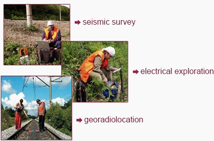
The Company is involved in geophysical surveys using radar, resistivity and seismology methods, and provides high-tech solutions for engineering geophysics.
Geophysical survey with the use of ground penetrating radar, seismology and resistivity exploration methods provides for the opportunity to receive valid and real-time data on soil slips, soils humidity level, water-bearing beds, as well as to determine in time caverns and define the soil-bearing capacity.
Geotech-Logis specialists are involved in development of various techniques for geophysical surveys in Russia, Moscow and Saint Petersburg.
COMPLEX OF GEOPHYSICAL TECHNIQUES
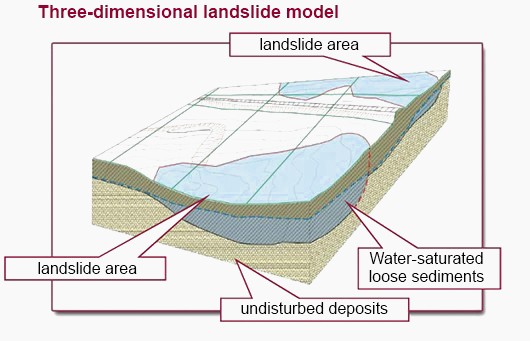
A complex of engineering and geophysical surveys and geophysical research allows to obtain an appearance model of the geologic deep structure of an area, study its geologic cross-section, define the boundaries and the ground nature. Engineering surveys with the use of geophysical research make it possible to conduct works in a complex environment – at boggy areas, when studying beds, inhomogeneous geologic features, at freeze-thaw action areas etc.
ADVANTAGES OF ENGINEERING AND GEOPHYSICAL SURVEYS
- •all conducted works assumes non-destructive testing;
- •continuous geological cross-sections of investigated environment are obtained;
- •drilling operations are reduced;
- •high efficiency and operational comfort.
GPR “OKO” provides for surveying at the vehicle moving speed.
TYPES OF INVESTIGATED OBJECTS AT THE DESIGN, CONSTRUCTION AND OPERATION STAGES


WHY Geotech-Logis?
 The company possesses a considerable surveying experience for over 20 years.
 Geotech-Logis combines the experience of the leading industry experts.
 Highly qualified specialists work in the company as regular staff members.
 Geophysical surveys are performed at the highest quality level.
 We have a long-term cooperation with many our customers. Gazprom, Rosneft, Russian Railways and Sheremetyevo, and Pulkovo airports are loyal customers of our company.
 Guaranteed passing of expert review.
 Scheduled operations performance.
 Permits and licenses required for rendering geophysical services.
 Apart from the routine tasks concerning engineering surveys, the company completes new and non-routine tasks set by its customers; we are involved in the development of new techniques for geophysical research.
COSTS OF GEOPHYSICAL SURVEYS
The company offers cost effective work performance using up-to-date equipment.
The following types of engineering and geophysical works are included in the stated price:
- •field works (GPR, seismology and resistivity exploration methods);
- •field work materials office study;
- •geophysical and engineering survey technical report.
Accurate price for engineering survey can vary depending on the features of investigated objects, terms of location and geophysical researches technique.
EXAMPLES OF GEOPHYSICAL SURVEYS IN RUSSIA, MOSCOW AND SAINT PETERSBURG
EXPLORE OF AERODROMES


Surveys of the motorways at the design, operation and renovation stages


-
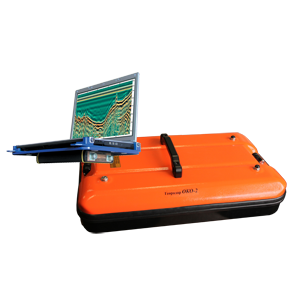
OKO‐3 NAUTILUS | UNDERWATER GROUND PENETRATING RADAR
The new development is the first underwater GPR of the OKO-3 series. The device received its unique properties due to the built-in underwater antenna AB-700M3P. Equipped with a central frequency of 700 MHz, it provides a wide range of possibilities...
-
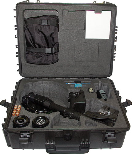
Ice Thickness Sensor LD-1200
The LD-1200 Ice Thickness Sensor is designed for non-contact and contact measurement of the thickness of fresh ice, detection of dangerous places (cracks, scours, voids) in real time. It has a convenient, lightweight, portable design for pedestrian operation: one-handed operation,...
-
Ice Thickness Sensor LD-400
The LD-400 hardware and software complex is developed on the basis of the OKO-3 series GPR complex with the MG-400 antenna for the prompt determination of ice thickness and structure, localization of inhomogeneity, cracks, and other defects within the ice...
-
OKO-3 GPR with a control unit
The OKO-3 GPR is a portable lightweight low-prices system designed for non-destructive environmental monitoring. The OKO-3 GPR includes the control unit and antennas. All antennas are interchangeable and meet the needs of a broad range of applications. The control unit is...
-
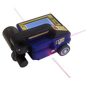
CONSTRUCTION SCAN 1700 3D
Construction Scan 1700 3D is a portable all-in one GPR solution designed for automated localizing defects in a wide variety of wood,brick and reinforcement concrete structures, at depth of 1 m. Construction Scan 1700 includes a control processing unit, LCD...
-
CONSTRUCTION SCAN 1700
Construction Scan 1700 is a portable, lightweight and easy-to-use GPR system designed for automatic real-time location of pipes, cables, reinforcement, cracks in concrete, brick, wood and other structures at a depth of up to 1 m. Application •Detection and location...
-
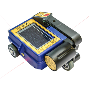
CONSTRUCTION SCAN 2500
Construction Scan 2500 is a portable all-in one GPR solution designed for automated localizing defects in a wide variety of wood,brick and reinforcement concrete structures, at depth of 0,6 m. Application •Detection and location of different defects in reinforced concrete...
-
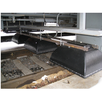
MULTICHANNEL GPR OKO-2 (FOR RAILWAY INSPECTION)
The multichannel GPR is designed for ballast examination APPLICATION •Determination of the railway embankment width and structure content •Allocation of subsidence in the ballast and natural bed layers •Determination of the natural bed •Mapping underground pipelines crossing railway embankment...
-
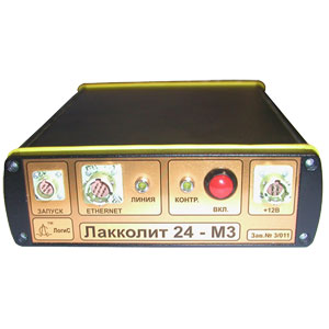
LAKKOLIT X-M4 DIGITAL MULTICHANNEL SEISMIC STATION
LAKKOLIT X-M4 is a digital multichannel engineering seismograph, designed for engineering geological and micro-zonation surveys by refracted wave, seismic refraction and vertical seismic profiling methods. Features •Data rate up to 100 Mb/s •Built-in electronic switchboard •Data recoding and preliminary processing...